0
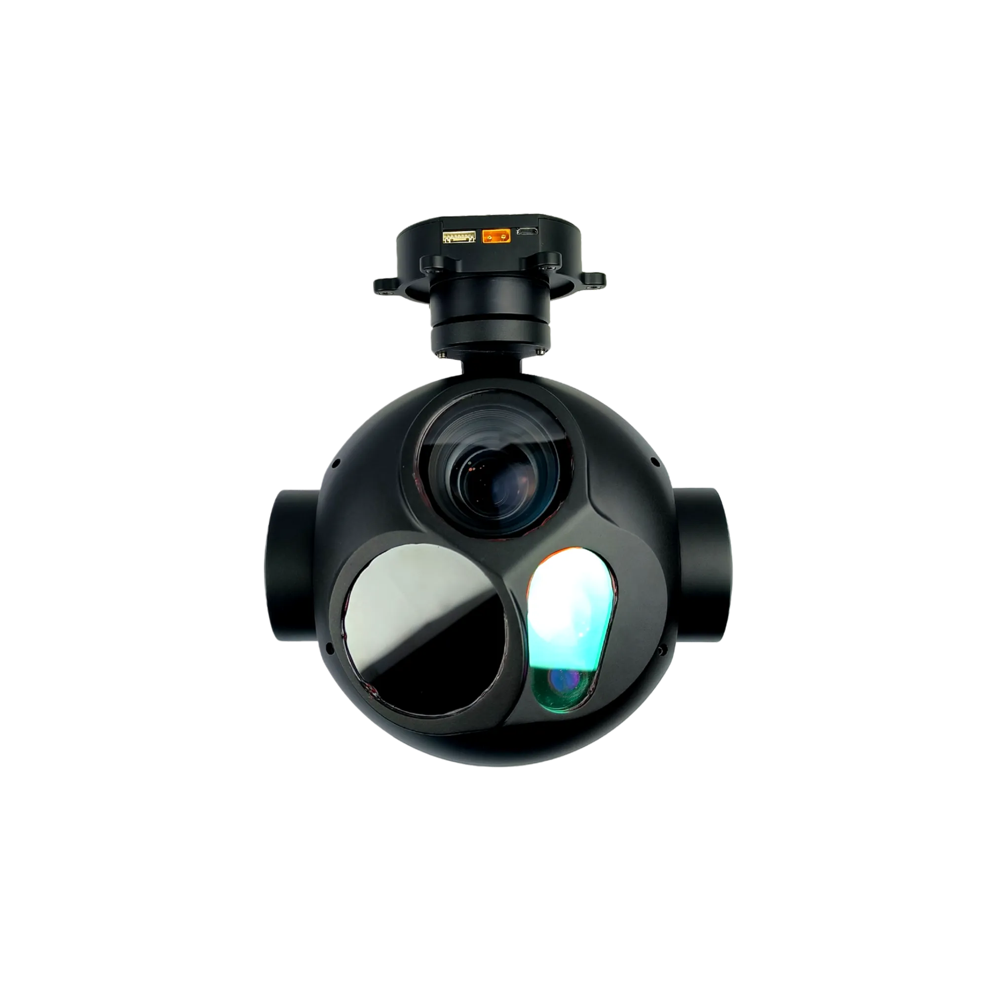
NTPOD305 Long Range Tracking Electro-Optical Pod
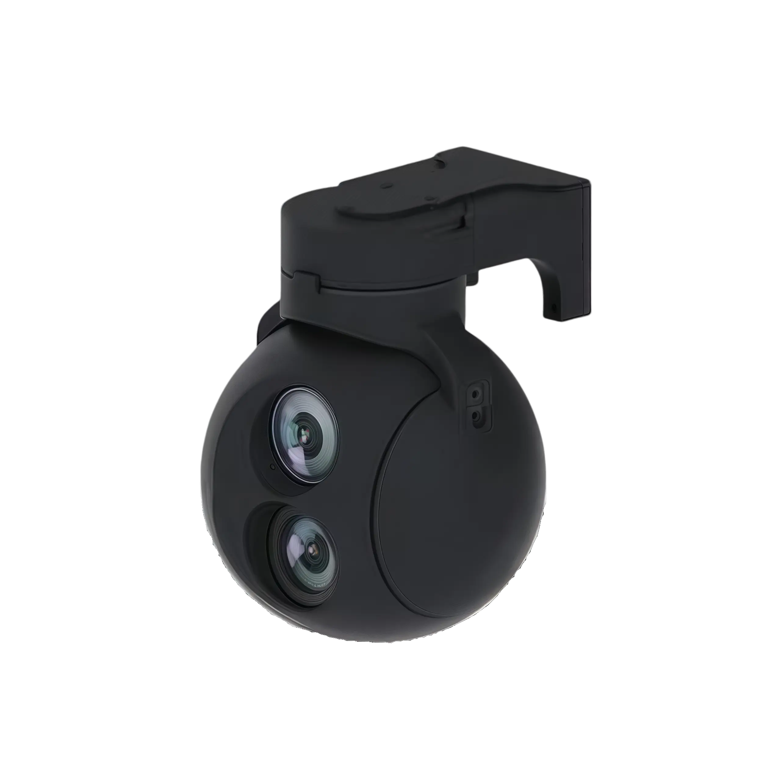
NTPOD80A Two-Axis Gyro-Stabilized Electro-Optical System
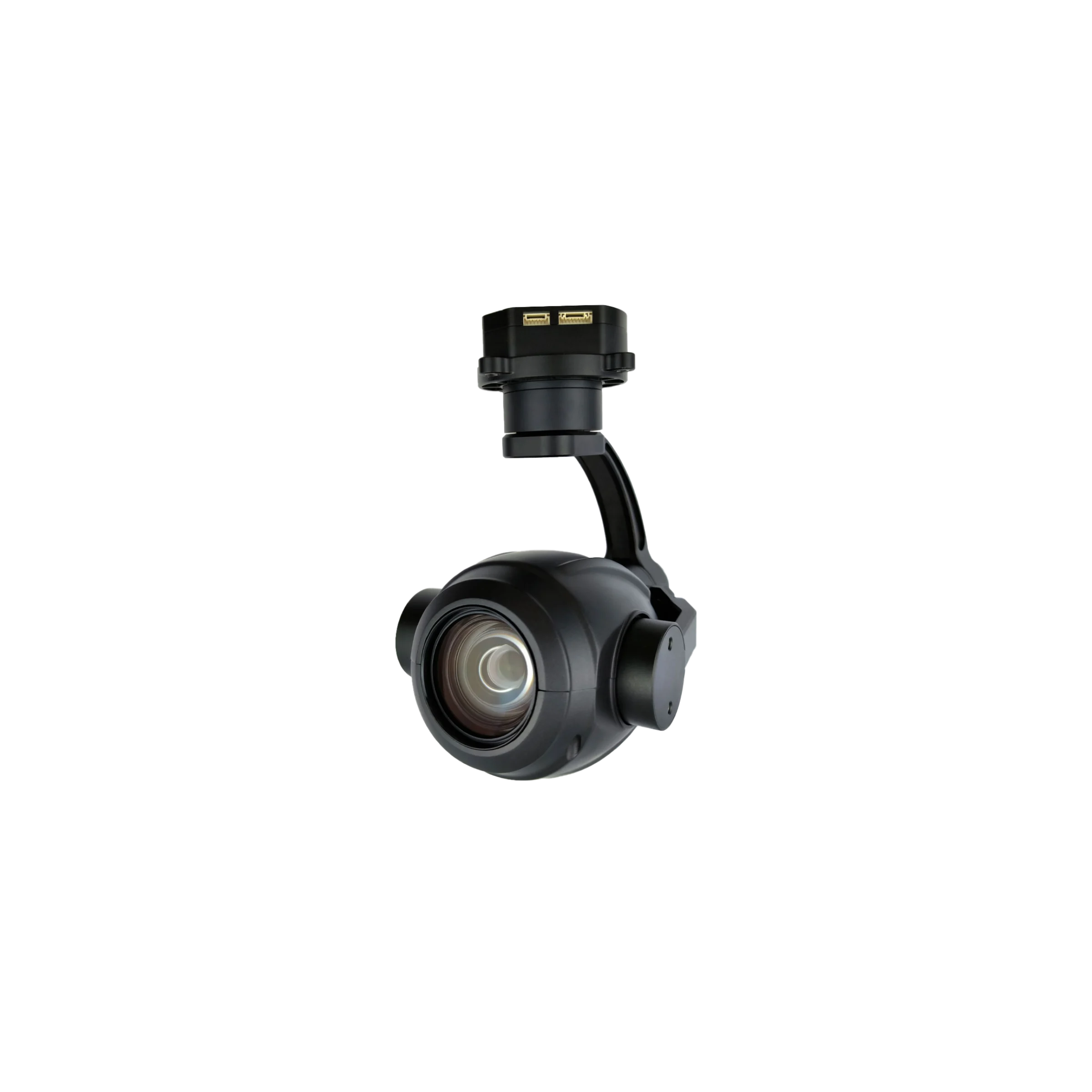
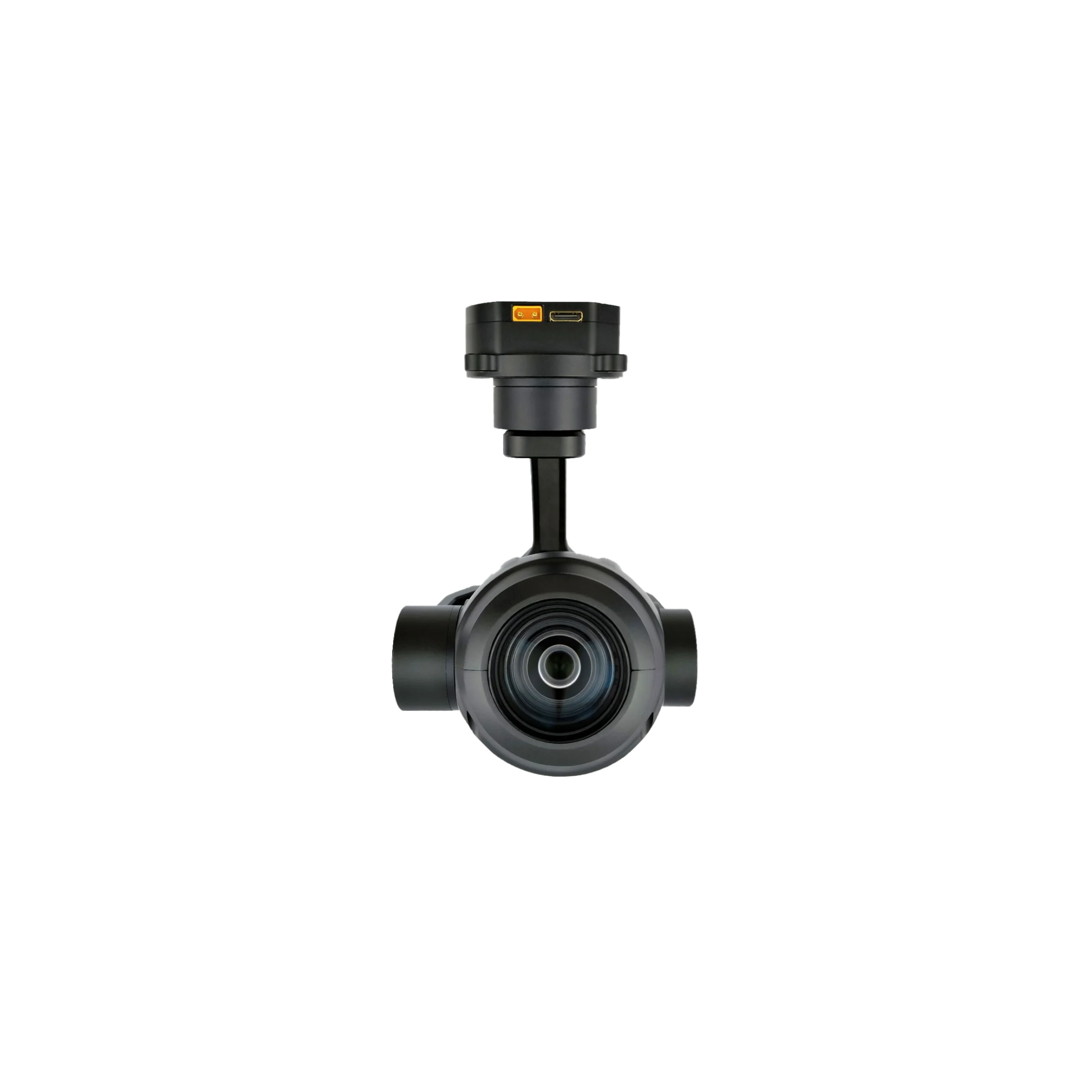
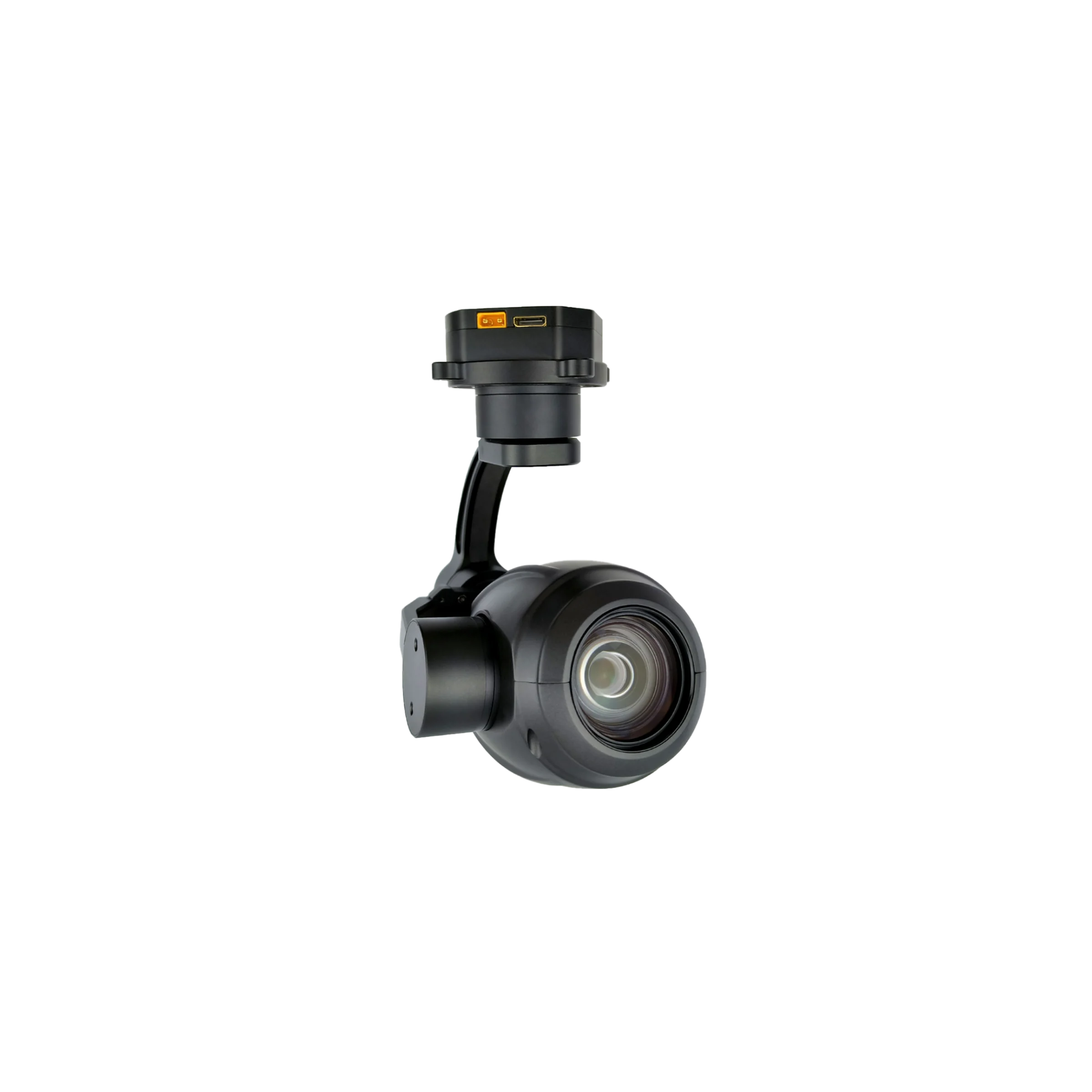
NTPOD207 Long Range Gimbal Electro-Optical Sensor
The NTPOD207 integrates an 8-megapixel STARVIS2 ultra-low-light sensor and an advanced 3-axis gyro-stabilized platform into a single lightweight payload structure. Engineered for long-range deployment, this system executes continuous real-time target capturing via high-fidelity optical instrumentation and specialized industrial data streaming pipelines. The entire optomechanical assembly maintains a highly optimized SWaP-C footprint to maximize flight endurance across diverse industrial aerial monitoring operations.
- Sensor Configuration: 1/1.8″ 8MP STARVIS2 CMOS sensor with 20× optical and 7× digital zoom.
- Stabilization Architecture: 3-axis FOC encoder platform achieving ±0.02° pitch/roll jitter.
- Operational Voltage Input: DC 12V–26.2V power supply with a 6.72W structural dissipation.
- Control Protocols: IP, S.BUS, and UART TTL integration with dual-way RTSP video streaming.
NTPOD207 Long Range Gimbal Electro-Optical Sensor Integration
Industrial aerial platforms require absolute stabilization and high-magnification clarity to execute precise infrastructure inspection without compromising vehicle runtime. The NTPOD207 long range gimbal electro-optical sensor resolves the physical limitations of weight-restricted flight by integrating a 140× hybrid zoom payload within a 690g structural enclosure. Driven by high-precision encoder Field-Oriented Control (FOC) algorithms, the integrated 3-axis stabilized mechanism isolates high-frequency platform vibrations to maintain a ±0.02° jitter threshold. This architectural optimization ensures that the 4K visible-light telemetry delivers stable, sharp image streams during long-range corridor mapping and critical asset auditing. By leveraging an ultra-low-noise 1/1.8-inch STARVIS2 sensor, this starlight night vision gimbal camera bypasses traditional low-light imaging degradation, maintaining high-resolution 3840×2160 video encoding at 30fps under sub-optimal ambient conditions.
For tier-1 system integrators and engineers, our high zoom drone gimbal camera provides a comprehensive hardware integration ecosystem supported by standard electrical interface blueprints. The network architecture establishes native RTSP dual-way control streams, allowing hardware developers to execute concurrent PTZ manipulation, real-time focus adjustments, and 4K local TF storage via remote PC application software. The dual physical interfaces—comprising a 6-pin IP net signal block and an 8-pin power/serial bus tracking interface—support direct S.BUS decoding and TTL level UART communications. This deep hardware compatibility eliminates integration overhead, allowing the AI tracking stabilized gimbal to function as an adaptable, production-ready node within complex automated inspection fleets and search and rescue networks.
NTPOD207 Core Optical Performance & AI Target Tracking Capabilities
- Ultra-High Hybrid Zoom Subsystem: Integrates an advanced 140× hybrid zoom system combining a 20× HD optical zoom lens (f=6.7±5%~125±5%mm) with a 7× digital zoom for ultra-long-range industrial inspection and surveillance.
- Premium SONY STARVIS2 Core: Equipped with a low-noise 1/1.8-inch 8-megapixel STARVIS2 CMOS sensor optimized for exceptional 4K and 1080P starlight night vision payloads.
- High-Precision 3-Axis Stabilization: Features a high-precision encoder FOC control scheme delivering a pitch/roll jitter angle of ±0.02° and a horizontal jitter angle of ±0.03° within a lightweight 690g sphere.
- Adaptive High-Speed Gimbal: Supports a wide operational range (Roll: -45°~+45°, Pitch: -30°~+120°, Yaw: -280°~+280°) with One-Click Restore and real-time Adaptive Speed Control.
- Target Tracking Thresholds: Executes localized neural network algorithms to maintain a dedicated lock on targets ranging from a minimum dimension of 16×16 pixels up to 256×256 pixels.
- Advanced Target Detection Scale: Drives automated inspection pipelines capable of registering and processing minimum target detection profiles of 32×32 pixels.
- High-Resilience Occlusion Window: Demonstrates high system resilience by maintaining continuous tracking lock through a maximum allowable total target occlusion period of up to 2 seconds.
- High-Velocity Processing Loop: Captures rapid motion with an automated processing capability that tracks targets at a maximum velocity of up to 50 pixels per frame.
- Massive Parallel Detection: Accelerates situational awareness by concurrently identifying and scanning a maximum simultaneous capacity of up to 100 targets.
- Deep-Learning Target Classification: Utilizes pre-trained industrial algorithms dedicated to accurately classifying and distinguishing human and vehicle entities.
- Dual-Channel Control Interface: Features flexible network 2-way control supporting IP, SBUS, or UART command protocols via a standard TTL interface.
- Broadcast-Grade RTSP Telemetry: Delivers high-definition H.264 video stream output over wireless networks alongside local 4K/1080P local TF card storage up to 128G.
NTPOD207 UAV Camera Payload Full Specifications
| System Electrical & Physical Parameters | |
| Operational Voltage Input | DC 12V – 26.2V |
| Power Dissipation | 6.72W |
| Structural Mass | 690g ± 10g |
| Physical Dimensions | 110mm × 109.6mm × 170mm |
| Gimbal Stabilization Assembly | |
| Roll Axis Range | -45° to +45° |
| Pitch Axis Range | -30° to +120° |
| Yaw Axis Range | -280° to +280° |
| Pitch & Roll Jitter Angle | ±0.02° |
| Horizontal Jitter Angle | ±0.03° |
| Position Alignment | One-click restoration to initial zero position |
| Velocity Control | Adaptive speed matching relative to focal length |
| Optical Sensor Architecture | |
| Imaging Sensor Core | 1/1.8-inch 8-Megapixel STARVIS2 Low-Noise CMOS |
| Magnification Range | 20× HD Optical Zoom Lens (f=6.7±5% to 125±5%mm), 7× Digital Zoom |
| Focus Execution Speed | Real-time automatic calculation < 1.0 second |
| Diagonal Field of View (FOV) | Wide 66.6°±5% to Tele 4.0°±5% |
| Horizontal Field of View (FOV) | Wide 59.6°±5% to Tele 3.5°±5% |
| Vertical Field of View (FOV) | Wide 35.7°±5% to Tele 2.0°±5% |
| Local Recording Resolution | 4K at 30fps / 1080P at 30fps |
| Edge Computing & Intelligence Module | |
| Minimum Tracked Target Profile | 16 × 16 pixels |
| Maximum Tracked Target Profile | 256 × 256 pixels |
| Occlusion Recovery Window | 2.0 seconds maximum allowable duration |
| Tracking Processing Velocity | 50 Pixels / Frame maximum threshold |
| Concurrent Acquisition Limit | 100 distinct targets simultaneously |
| Classification Matrix | Human entities and industrial vehicles |
| Minimum Detection Profile | 32 × 32 pixels |
| Storage & Communications Architecture | |
| Local Media Storage | MicroSD / TF Card slot up to 128GB (Class 6 and above) |
| Static Image Layout | JPEG format (multi-resolution options available) |
| Compressed Video Pipeline | H.264 stream output over wireless network, 4K local container |
| Interface Protocols | IP Net, S.BUS, UART TTL Command Line |
| Thermal Operational Constraints | -10°C to +55°C / 20% to 80% RH (Non-condensing) |
| Storage Thermal Threshold | -20°C to +60°C / 20% to 95% RH |
Device Structure and Mechanical Dimension Parameters
The mechanical frame of the payload features an ultra-compact structural envelope optimized for SWaP-C limited airframes. The industrial housing isolates the inner optomechanical axis from external wind shear while ensuring precise clearance dimensions across maximum pitch, roll, and yaw deflection sweeps.
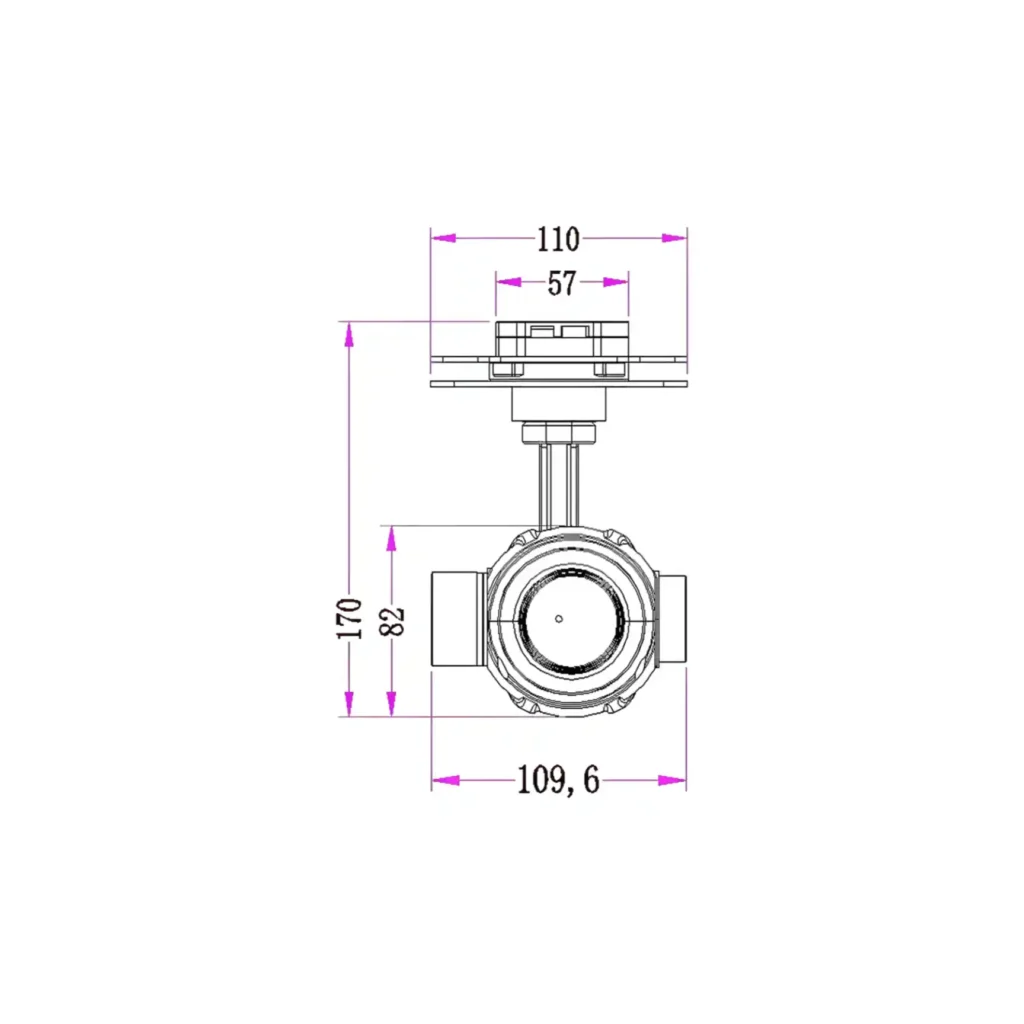
Structural Dimensions Profile: Outer clearance limits scale at 110mm width by 109.6mm depth, with a total vertical structural axis length of 170mm from the damping connector adapter base.
- The primary stabilized sensor enclosure features a centralized 82mm core sphere profile to minimize aerodynamic drag coefficients.
- The upper mechanical mounting assembly layout spans a specialized 57mm stabilization adapter interface footprint for quick-release mating.
- The entire structural architecture maintains an ultra-lightweight structural mass threshold capped at 690g ± 10g to extend drone battery deployment lifespans.
Electrical Interface Blueprint and Connector Pinout Assignments
The NTPOD207 electrical interconnect architecture provides hardware developers and tier-1 system integrators with standard TTL pinout paths and native IP net block definitions to achieve low-latency system integration. This multi-channel routing pipeline facilitates real-time PTZ command execution and dual-way network video streaming concurrently. For internal data containment and firmware deployment, a localized MicroSD/TF memory card slot is accessible directly on the gyro-stabilized sphere assembly.
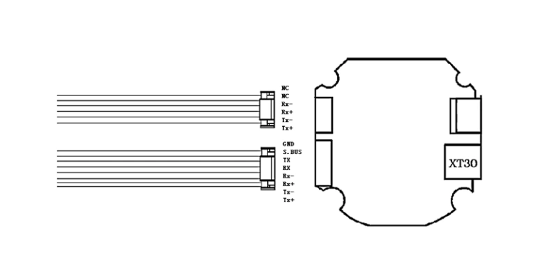
Deployment Specification: Hardware integration can be streamlined by multiplexing the full-functional 8-pin receptacle, which shares common IP NET data nodes while clustering main power rails, S.BUS input, and TXD3/RXD3 serial control tracks.
| 6-Pin External Signal Block Pinout Definitions | |||
| No. | Interface Type | Pin Definition | Functional Routing |
| 1 | Signal block | Backup Pin | Reserved / Unassigned Channel |
| 2 | Signal block | Backup Pin | Reserved / Unassigned Channel |
| 3 | Signal block | Rx- | IP NET Data Receive Channel |
| 4 | Signal block | Rx+ | IP NET Data Receive Channel |
| 5 | Signal block | Tx- | IP NET Data Transmit Channel |
| 6 | Signal block | Tx+ | IP NET Data Transmit Channel |
| 8-Pin Main Power & System Control Serial Interface | |||
| No. | Interface Type | Pin Definition | Functional Routing |
| 1 | Power interface | GND | System Ground Return |
| 2 | Signal block | SBUS | S.BUS RC Receiver Input Channel |
| 3 | Signal block | TXD3 | UART Command Transmission Line |
| 4 | Signal block | RXD3 | UART Command Receiving Line |
| 5 | Signal block | Rx- | IP NET Data Receive Channel |
| 6 | Signal block | Rx+ | IP NET Data Receive Channel |
| 7 | Signal block | Tx- | IP NET Data Transmit Channel |
| 8 | Signal block | Tx+ | IP NET Data Transmit Channel |
Industrial Application Scenarios & Field Deployments
- Power Grid & Critical Infrastructure Inspection: Bypasses high-voltage magnetic field interference to perform long-range corridor mapping, overhead transmission line auditing, insulator defect detection, and wind turbine blade monitoring without entering dangerous proximity zones.
- Pipeline & Transit Corridor Surveys: Mounts natively onto long-endurance multi-rotor or fixed-wing UAV platforms to execute linear surveys across hundreds of kilometers of oil, gas, or chemical pipelines and track railway track degradation via real-time H.264 network streaming.
- Search and Rescue (SAR) & Emergency Response: Combines low-noise 4K starlight night vision telemetry with continuous real-time target tracking down to 16×16 pixels to locate missing persons, survey post-disaster wreckage, and coordinate emergency teams through pitch-black conditions.
- Industrial Asset Logistics & Yard Tracking: Deploys advanced localized neural network algorithms to automate large-scale equipment and vehicle tracking within shipping ports, major cargo container yards, and factory compounds by concurrently scanning up to 100 targets.
- Commercial Perimeter Security & Boundary Patrol: Integrates directly into automated drone-in-a-box deployment systems to secure mining sites, industrial facilities, and agricultural fields by executing automated PTZ patrol routes and high-velocity vehicle classification loops.
- Environmental Monitoring & Wildlife Survey: Utilizes ultra-long-range 140× hybrid zoom capabilities to perform ecological payload mapping, coastal erosion tracking, and non-disruptive wildlife population audits over dense forestry gaps and conservation areas.
Multispectral & Telemetry Scaling Options: This starlight night vision gimbal camera interfaces natively with our modular flight control infrastructure. For comprehensive all-weather deployment profiles requiring an integrated uncooled long-wave infrared thermal sensor or precision distance tracking, evaluate our multi-sensor flagship NTPOD305 Laser Rangefinder Gimbal Camera portfolio or examine the quick-disconnect NTPOD125B Tri-Sensor Pod specifications to acquire comprehensive multispectral mapping blueprints.
SWaP-C Payload Minimization Layouts: If your structural carrier airframe demands aggressive mass containment or alternative dual-light optical zoom distribution configurations, cross-reference the technical matrices of our ultra-lightweight NTPOD64 Three-Axis Gyro-Stabilized Micro Pod (weighing ≤260g) or transition to the continuous-zoom NTPOD100 LWIR Thermal Pod framework to balance structural payloads.