0
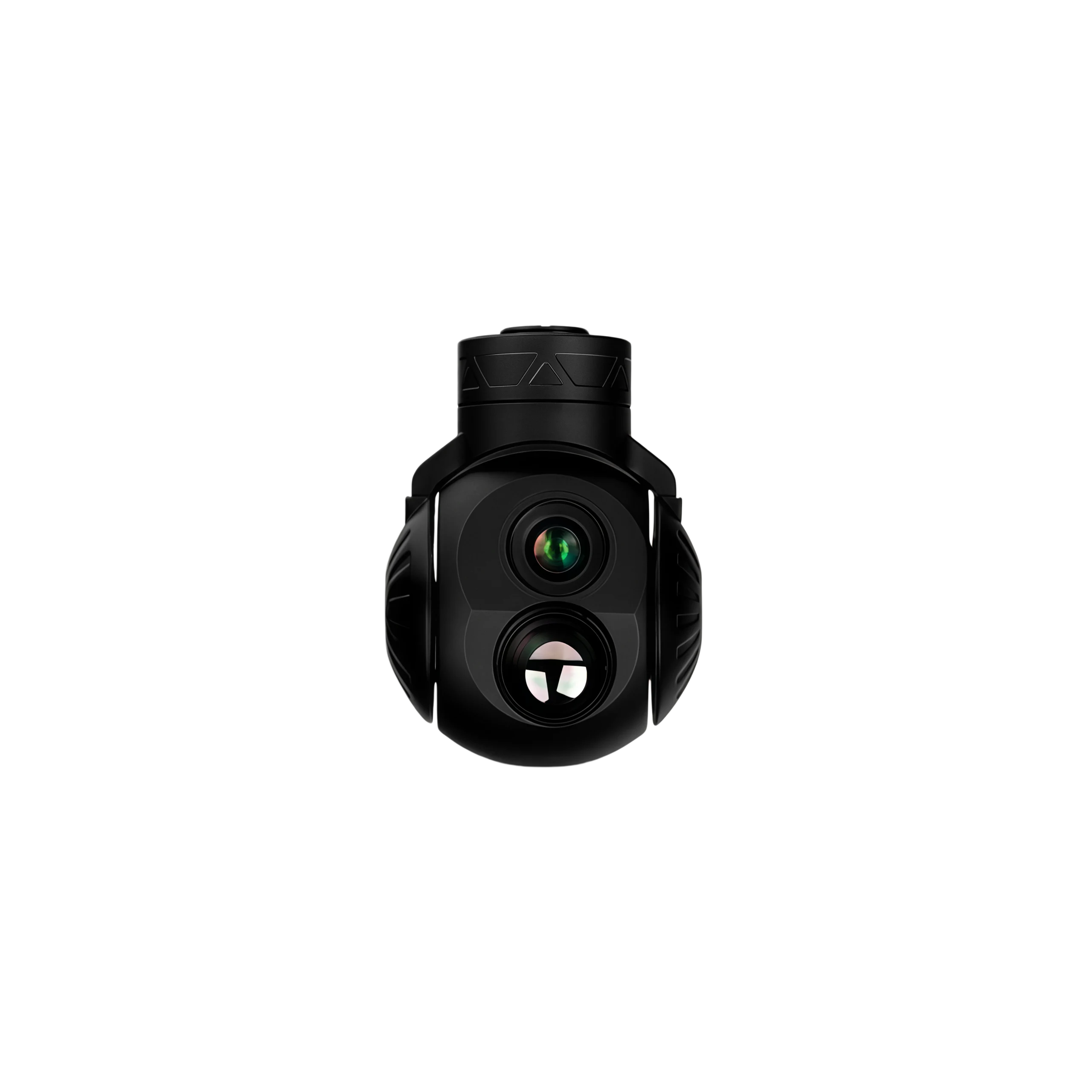
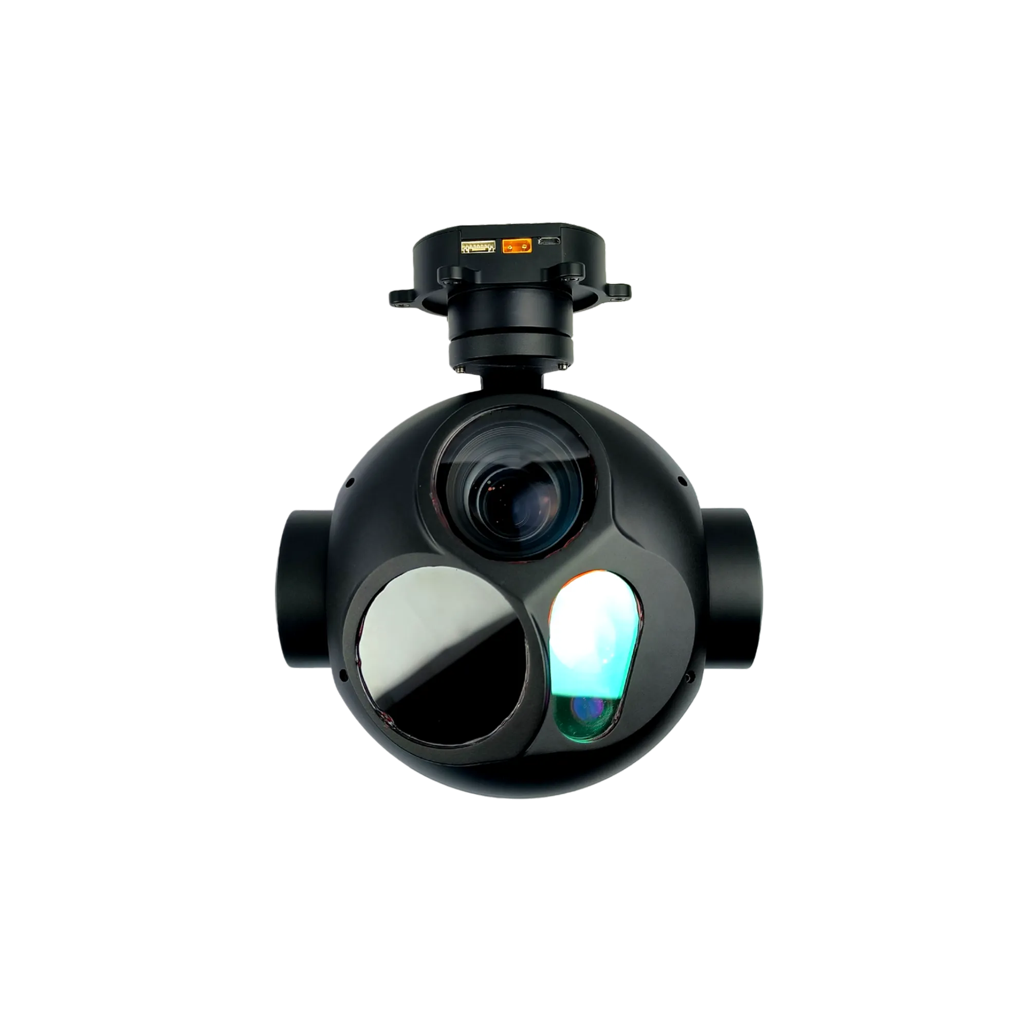
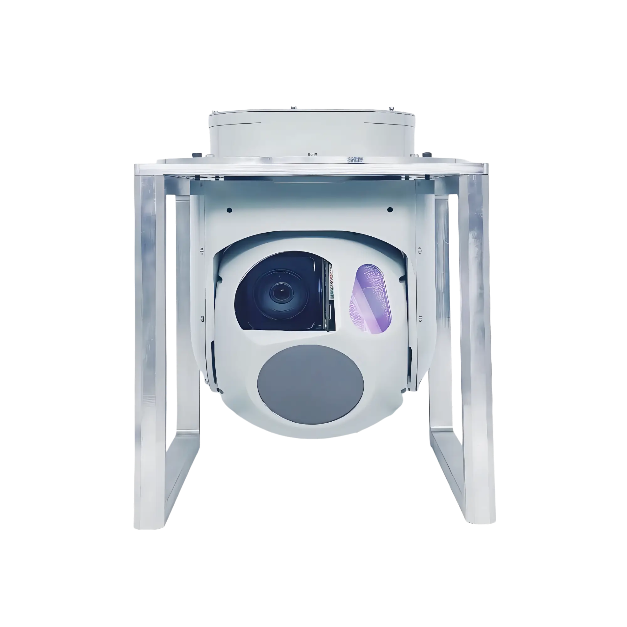
NTPOD190B Long Range Electro-Optical System
The NTPOD190B Long Range Electro-Optical System is a 3-axis gyro-stabilized multi-sensor payload calibrated for ≤0.1 mrad boresight alignment error. Developed by NTRON for industrial UAV airframes, it supports factory-direct wholesale scaling and direct SDK hardware integration.
- Sensor Configuration: 8MP camera with 30× optical zoom and a 640×512 uncooled LWIR thermal core.
- Laser Rangefinder: Integrated eye-safe 1540nm module with a 100m to 5000m tracking range.
- Physical Profile: Form factor of Φ190mm × 279.9mm with a total structural weight of <4.8kg.
- Control Protocols: Dual-channel asynchronous RS422 ports supporting S.BUS and Pelco-D architectures.
NTPOD190B Long Range Electro-Optical System Profile
The NTPOD190B is a high-performance, three-axis stabilized long range electro-optical system engineered for seamless deployment onto commercial unmanned aerial vehicles (UAVs), robotic automation platforms, and remote maritime monitoring infrastructure. Developed under strict SWaP-C Optimization principles, this multi-spectral platform consolidates an 8MP visible-light sensor, a 640×512 Uncooled LWIR Core, and an eye-safe 1540nm laser rangefinder module within a ruggedized, fully shielded enclosure. This deep Optical-Mechanical-Electrical Integration minimizes operational latency and provides synchronized, real-time spatial data tracking under harsh environmental conditions.
Engineered to meet the stringent demands of global system integrators, each NTPOD190B unit undergoes meticulous factory Boresight Alignment to guarantee an Optical Axis Deviation of ≤ 0.1 mrad. This precision-calibrated alignment eliminates cross-sensor registration drift during continuous zoom operations, providing reliable, repeatable telemetry data for corridor mapping, environmental surveying, and automated target tracking without requiring frequent field recalibration.
Core Functions of the System
- Dual-Channel Vision Tracking: Toggles between visible and thermal tracking layers. Bypasses smoke and fog to achieve an industrial detection range of ≥3.5km and an identification range of ≥1.8km in zero-light conditions.
- Line-of-Sight Gyro Stabilization: Uses reactive torque motors for 3-axis stabilization, locking Line-of-Sight precision to ≤0.1 mrad (RMS). Supports ≥60°/s search velocity and 360° continuous yaw to cancel airframe jitter.
- Edge AI Target Georeferencing: An onboard computing matrix executes automated tracking and concurrent identification for up to 20 targets. Fuses aircraft telemetry with optical vectors to output real-time coordinate data.
- Environmental Protection & I/O: Rated at IP54/IP67 across an operational window of -40°C to +55°C. Outputs low-latency network digital video streams and provides open SDK schemas for direct integration.
NTPOD190B Long Range Electro-Optical System Technical Specifications
| Gimbal Platform & Mechanical System Parameters | |
| Operational Voltage Input | 28 VDC |
| System Power Dissipation | Average ≤ 50W, Peak ≤ 150W |
| Structural Mass Assembly | < 4.8 kg |
| Physical Form Factor Dimensions | Φ 190 mm × 279.9 mm |
| Ingress Protection Rating | IP54 / IP67 Industrial Standard |
| Communication Interface Architecture | 2-channel Asynchronous RS422 Serial Port |
| Digital Video Streaming Channel | 1-channel Network Digital Video Output |
| Thermal Operational Window | -40°C to +55°C |
| Storage Thermal Limits | -45°C to +65°C |
| Maximum Search Angular Velocity | ≥ 60°/s |
| Maximum Tracking Angular Velocity | ≥ 10°/s |
| Line-of-Sight (LOS) Stabilization Precision | ≤ 0.1 mrad (RMS) |
| Automated Tracking Precision | ≤ 0.5 mrad (RMS) |
| Kinematic Angular Measurement Precision | ≤ 1 mrad |
| Mechanical Pitch Angle Range | -110° to +10° |
| Mechanical Yaw Angle Range | 360° Continuous Rotation |
| Visible Light Electro-Optical Tracking Sensor Specifications | |
| Sensor Matrix Resolution | 1920×1080 (1080P, 8MP CMOS Sensor) |
| Spectral Bandwidth Operation | 0.4 µm to 0.7 µm |
| Optical Field of View (FOV) Range | 2.4°×1.35° to 58°×32.62° |
| Optical Zoom Configuration | 30× Continuous Optical Zoom |
| Long Range Observation Metrics | Detection Range: ≥ 7 km, Identification Range: ≥ 4 km (Target size: 4m × 6m) |
| Image Processing Features | Autofocus, Real-Time Focus, Picture-in-Picture, Digital Enhancement |
| Uncooled Thermal Imaging Electro-Optical Sensor Payload | |
| Sensor Matrix Resolution | 640×512 (Uncooled LWIR Core) |
| Spectral Bandwidth Operation | 8 µm to 12 µm |
| Infrared Dynamic Range Performance | Detection Range: ≥ 3.5 km, Identification Range: ≥ 1.8 km (Target size: 4m × 6m, 5K differential) |
| Image Processing Features | Optical Continuous Zoom, Autofocus, Polarity Reversal, Non-Uniformity Correction (NUC) |
| Integrated Laser Rangefinder Module Telemetry Parameters | |
| Laser Operational Wavelength | 1540 nm Safe Band |
| Rangefinding Measurement Precision | ± 1 m |
| Module Operational Blind Zone | 100 m |
| Rangefinding Distance Capacity | 100 m to 5000 m |
NTPOD190B Mechanical Dimensions & Structural Profile Blueprint
The mechanical blueprint details the exact spatial structural envelope and precise technical dimensions of the NTPOD190B airborne tri-sensor pod. This standardized architecture ensures seamless mechanical integration with heavy-lift commercial UAV gimbals and automated fixed-wing payload adapters.
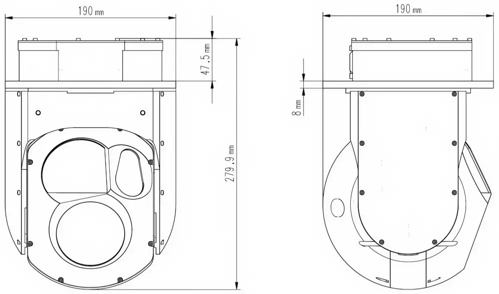
Outer Diameter Matrix: Φ190mm | System Total Height: 279.9mm | Top Mounting Base Depth: 47.5mm | Installation Flange Plate Thickness: 8mm. The engineering drawing verifies the compact, aerodynamically balanced profile for critical payload payloads.
UAV & Airborne Tri-Sensor Gyro Gimbal Target Industry Applications
- UAV Infrastructure Inspection: Deploys a high-fidelity 2MP optical tracking matrix and active 3-axis gyro stabilization to streamline automated macro-structural health surveys and line sagging measurements.
- Substation Thermal Infrared Diagnostics: Leverages the 640×512 VOx microbolometer core to diagnose critical surface overheating anomalies and transformer structural defects without field shutdowns.
- Linear Corridor Utility Patrols: Employs continuous 360° horizontal yaw panning and dual-channel RTSP 1080P networking to monitor remote infrastructure routing networks and isolated industrial boundaries.
- Precision Distance Mapping Validation: Interfaces a 5000m eye-safe laser rangefinder module to supply absolute target geometry metadata directly into structural inspection data workflows.
- Automated Asset Defect Inventorying: Directs an onboard Edge AI processing core to automatically tag, monitor, and log up to 100 industrial infrastructure profiles concurrently across low-visibility environments.
Engineering Integration Note: This stabilized long range electro-optical system seamlessly interfaces with our factory-direct laser telemetry subsystems. For advanced optoelectronic pairings or cross-spectrum sensor alignment configurations, view our specialized 1535nm Laser Rangefinder Sensor deployment portfolio or consult our engineering division for custom SDK schema documentation.
For industrial airborne observation systems requiring large-aperture laser target designator capabilities for heavy drone frames, evaluate the flagship NTPOD380A Airborne System Payload or our lightweight continuous-zoom NTPOD115 Three-Axis Electro-Optical Pod.